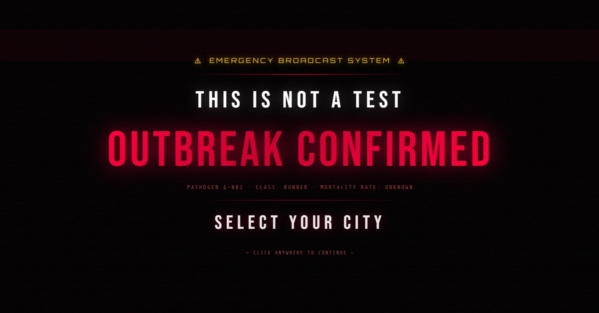
Everyone expected another polished demo. A slick animation here, a slightly faster data retrieval there. We’ve grown accustomed to incremental improvements, the gentle nudging of the technological envelope. But what if I told you the future of complex simulation isn’t just knocking; it’s kicking down the door with a horde of the undead?
This isn’t just another weekend project. This is a fundamental platform shift made manifest in digital shambling corpses. We’re talking about a real-time zombie outbreak simulator that doesn’t just plot random circles on a map. Oh no. This beast simulates actual city structures, use road networks, considers weather vectors like wind, and even models population densities. It’s a gritty, detailed, 60 FPS vision of urban collapse, built on some seriously cool tech.
More Than Just a Game: A New Way to Simulate
When you want to simulate thousands of geographical zones in real-time, you can’t afford to clog up your main UI thread. Trying to run heavy-duty math directly in the browser’s primary loop is like asking a single chef to cater a banquet for ten thousand people – it’s going to grind to a halt faster than you can say ‘Brains!’ The solution? Splitting the workload with Web Workers. The main thread handles the pretty visuals – the MapLibre GL rendering, the 3D building extrusions, the particle tracers – while a dedicated background worker crunches the apocalyptic numbers.
This separation is key. The worker becomes the simulation’s engine, managing the entire grid’s state, processing data incrementally, and only sending back the essential, lightweight updates needed to keep the UI alive and kicking. It’s a dance of concurrent computing, keeping the experience buttery-smooth, even as London becomes an all-you-can-eat buffet.
The Math Behind the Mayhem: SIZD Model
Forget the tired old SIR (Susceptible, Infected, Recovered) models. Zombies don’t exactly ‘recover,’ do they? This simulation upgrades to a custom SIZD Model: Susceptible, Infected, Zombie, and Dead. Every single cell on the map undergoes differential equation steps with every tick of the simulation clock. We’re talking about parameters that dictate how fast the Infected turn into ravenous Zombies (gamma), the effectiveness of human resistance (delta), and even the chances of a civilian becoming a zombie after an encounter.
Notice that in the horde configuration, conversion rates double (0.32), giving civilians almost zero time to get their affairs in order.
And the zombie kill-rate coefficient (delta) plummets in horde mode, pushing human defense efficacy to a truly despair-inducing 0.006. This isn’t just math; it’s the grim arithmetic of survival.
Hexagons: The Shape of Apocalypse
Why hexagons? Why not squares? Because traditional latitude/longitude blocks warp reality near the poles and make distance calculations a computational nightmare. Spherical trigonometry over thousands of points? Slow. Uber’s H3 Hexagonal Hierarchical Spatial Index elegantly sidesteps this. Every neighbor of a hexagonal cell is equidistant from its center. This makes the propagation of cellular automata waves – like an infectious disease – beautifully simple and incredibly efficient.
Inside the worker loop, calculating spread to neighboring areas is handled by h3.gridDisk. The simulation can efficiently query these hexagonal neighbors, determine spread probabilities, and infect adjacent cells. It’s spatial indexing turned into a weapon against realism.
The Real-Time Challenge: Web Workers Save the Day
Here’s the thing about real-time simulations: they demand performance. And when you’re talking about thousands of geographical zones, each with its own population, infection status, and potential for zombification, the computational load is immense. Direct DOM manipulation and complex calculations on the main thread would bring even the most powerful machines to their knees. This is where Web Workers become the unsung heroes.
By offloading the heavy lifting – the SIZD model calculations, the H3 spatial indexing, the pseudo-random number generation – to background threads, the main UI thread remains responsive. Users get a fluid, interactive experience, able to pan, zoom, and witness the simulated apocalypse unfold at a consistent 60 FPS, without the dreaded browser freeze.
This project isn’t just a clever use of existing tools. It’s a demonstration of how fundamental web technologies, when combined with elegant spatial indexing and sophisticated mathematical modeling, can create experiences we once only dreamed of. It hints at a future where complex simulations aren’t confined to high-powered desktops but are accessible, interactive, and visceral, right in our web browsers. The zombie apocalypse might be terrifying, but the engineering behind this simulation? That’s something truly exciting.
🧬 Related Insights
- Read more: The Full-Stack Tax: Why JavaScript Backends Are Bleeding You Dry
- Read more: HarmonyOS @State Blind to Singleton Tweaks
Frequently Asked Questions
What does the H3 spatial index do? H3 is a hexagonal hierarchical spatial indexing system developed by Uber. It divides the world into hexagonal cells at different resolutions, making it highly efficient for geospatial analysis and calculations like proximity and neighborhood queries.
Why are Web Workers important for this simulation? Web Workers allow JavaScript code to run in background threads, preventing computationally intensive tasks like the simulation’s math and data processing from freezing the main user interface thread. This ensures a smooth, real-time experience.
Is this simulator just for fun, or does it have practical applications? While the zombie theme is for entertainment, the underlying technologies and simulation approach – using H3 for spatial partitioning and Web Workers for performance – have practical applications in fields like disaster modeling, urban planning, real-time logistics, and environmental simulations.